Trig Pro
See the view before you climb.
Explore interactive 3D panoramas from where you stand or from any summit, follow the sun and the moon across the sky, and take whole regions offline.
Monthly, yearly or a one-time lifetime unlock. Prices are shown in the App Store in your currency.
Summit views
Stand on any summit.
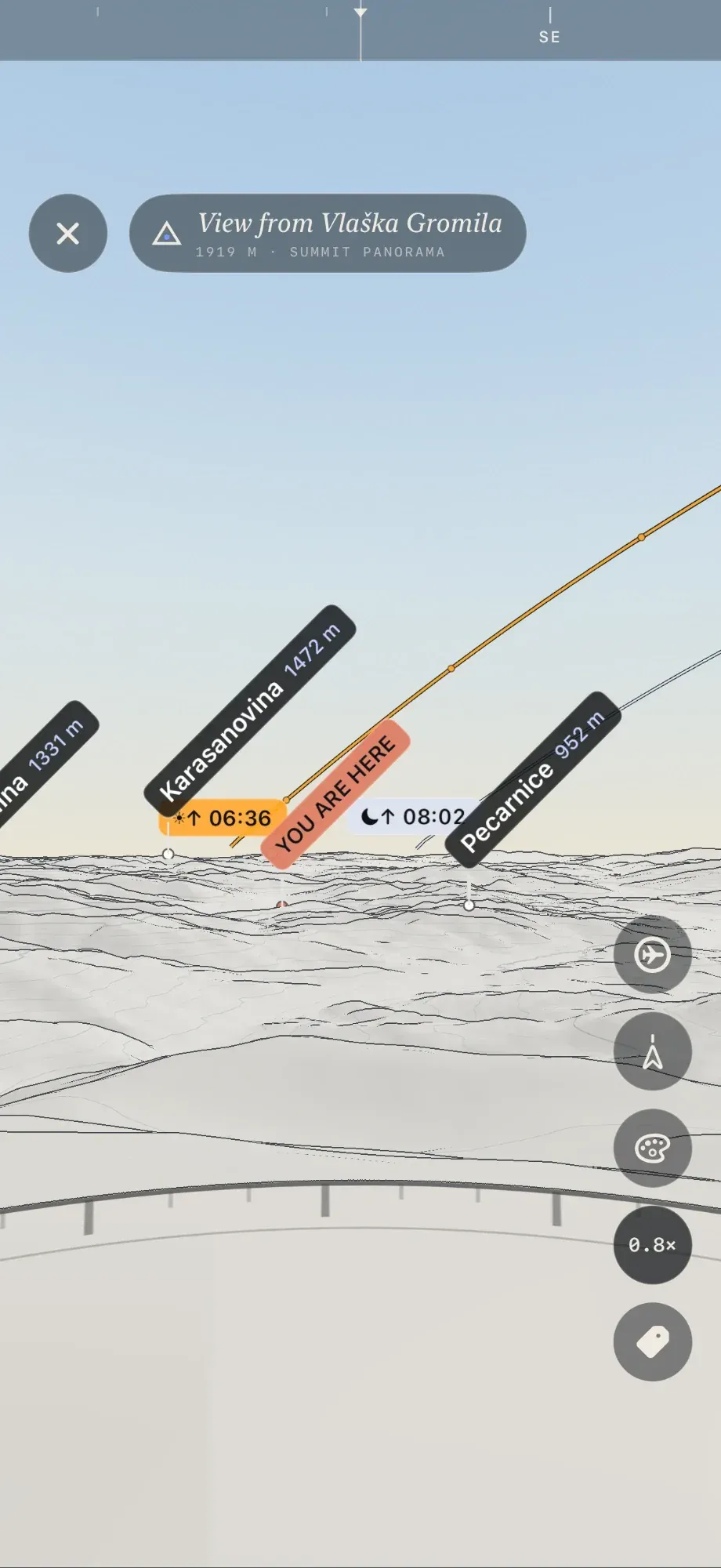
Open a 3D panorama from your own position, or from any peak you tap in Field, and see the view from that mountain top before you set out. It is a virtual summit view built from real elevation data, with the skyline drawn ridge by ridge and the peaks on the horizon labelled. Drag to look around, switch to aerial view, and pinch to fly across the terrain. Tap a label for the peak’s details.
- From your location or any summit
- Aerial view: drag to orbit, pinch to fly
- Single tap for peak details
Terrain palettes
Read the land three ways.
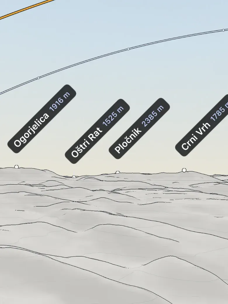
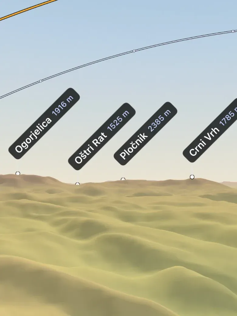
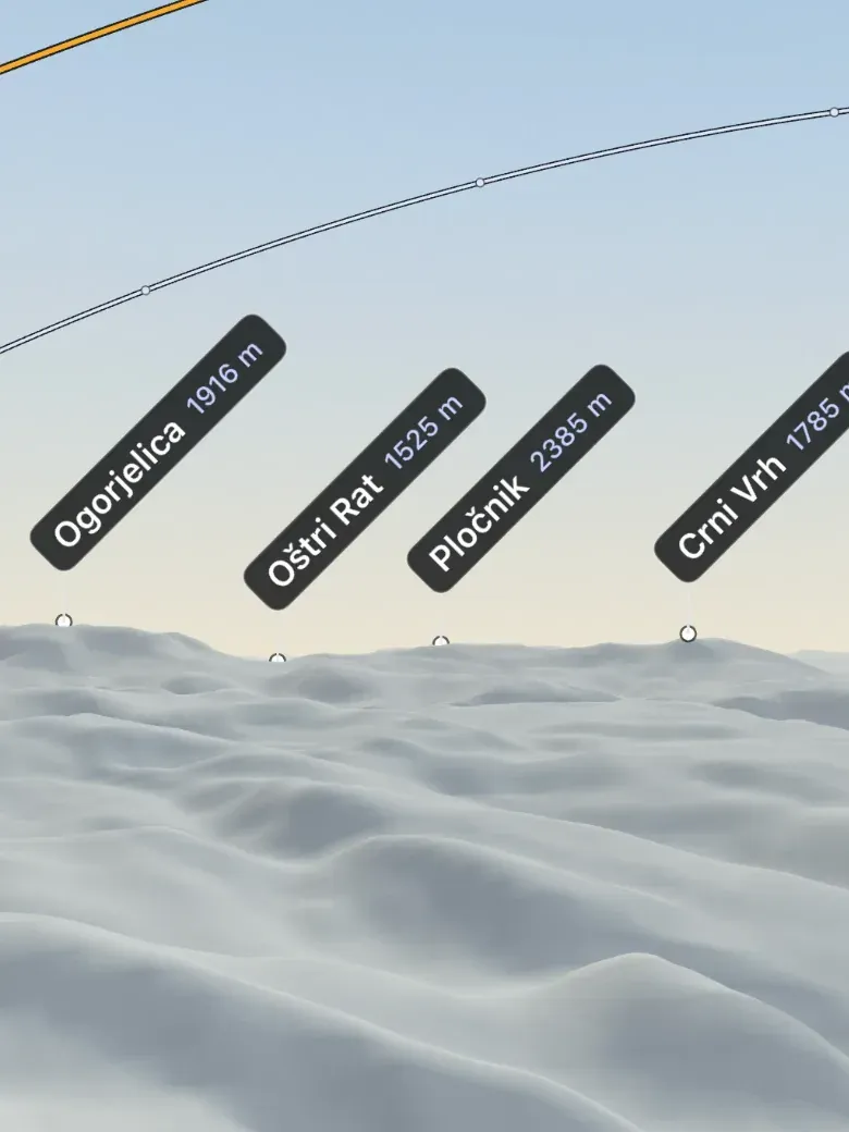
Print contours draw the land in ink on white paper, like an engraved map. Elevation colours put every height on one fixed scale, with a legend in metres. Shaded relief shapes slopes and ridges with light alone.
Sun and moon paths
Know where the light will be.
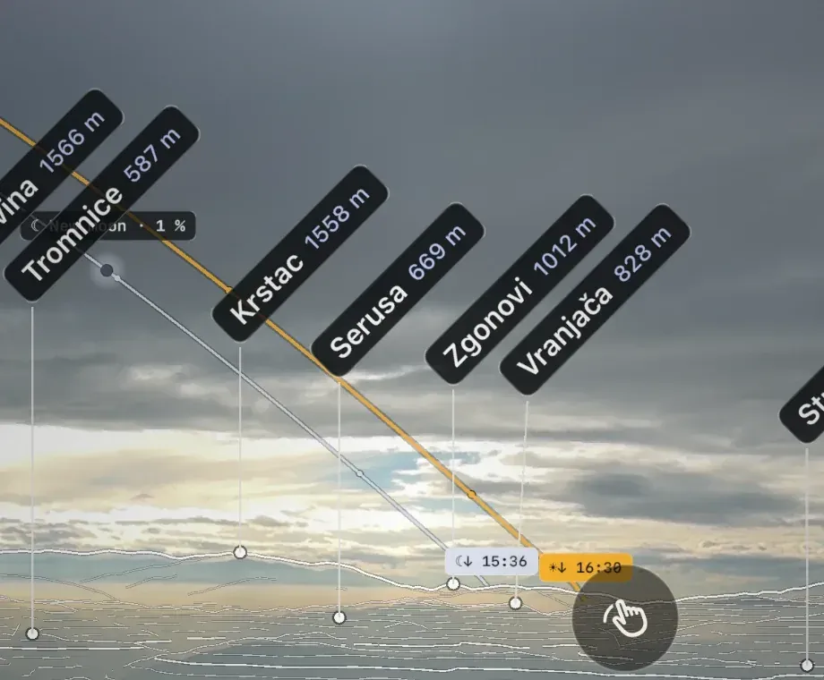
A gold arc traces the sun across the sky for the day, over the real terrain around you. The moon follows its own arc, rising and setting on the same horizon. Plan the sunrise from a summit, or check when a valley falls into shadow.
Camera lenses
Frame it like a camera.
Natural shows roughly what your eyes see. Wide takes in a whole range. Detail pulls a distant summit closer.
Field of view across the short side of the screen, standing on the ground.
Offline regions
Save a region to your phone and use it anywhere.
Pick an area before you go and Field, the map and peak details keep working with no signal. Trig checks every layer and tells you when the region is ready.
- Radius from 5 to 150 km around a point you choose
- Topographic and Satellite maps, Regional (zoom 0–10) or Detailed (zoom 0–14)
- Terrain for the region plus a 30 km scan range around it
- Peaks from the built-in catalogue, verified for the whole area
Terrain out to 100 km
When you are online, a panorama can load terrain out to 100 km for the farthest ridges. Missing terrain is left as a gap, never invented.
Free and Pro, side by side
| Free | Pro | |
|---|---|---|
| AR Scan with terrain-confirmed peak names | Included | Included |
| Map with peak details and sharing | Included | Included |
| Camera height for elevated viewpoints | Included | Included |
| 3D summit panoramas, ground and aerial | Not included | Included |
| Print contours, elevation colours and shaded relief | Not included | Included |
| Sun and moon paths | Not included | Included |
| Natural, Wide and Detail lenses | Not included | Included |
| Offline regions with maps, terrain and peaks | Not included | Included |
Choose how you pay
All plans unlock the same Trig Pro. Apple shows the price in your currency before you buy and handles payment. No Trig account is needed: Pro belongs to your Apple Account.
Questions about Pro
Is the AR Scan free?
Yes. Identifying peaks with the camera, the map and peak details are free. Pro adds panoramas, palettes, sun and moon paths, lenses and offline regions.
What does Lifetime include?
Every Trig Pro feature, unlocked with one purchase and no renewal. It does not change terrain coverage or data accuracy.
How do I restore Pro on another iPhone?
Sign in with the same Apple Account and open Settings → Trig Pro → Restore in Trig.
How do I cancel?
Open Settings → Trig Pro → Manage subscriptions in Trig, or your subscriptions in iPhone Settings. Pro stays active until the end of the period you paid for.
What the free app includes · Terms of Use · Privacy Policy · Back to Trig